Table of Contents
Comparison of Ground-Based and GEOS-R Fog and Low Stratus Observations over North Dakota
Reports
February 22, 2022: Submitted Report Progress - Limited progress in the first month. We have setup the project management tasks and started to select case dates from conducting the comparison. Have worked on extracting the visibility data set from our CHORDS data base system. Next tasks will be to download satellite data for the dates selected.
April 6, 2022: The data for the December 15, 2021 fog event in Fargo, ND has been collected.
April 22, 2022: The data for the October 28, 2021 fog event in Fargo, ND has been collected.
June 28, 2022: Satellite data for each fog event, thus far, has been collected and put in its respective folders. Waiting for Satellite script to be fixed (it works fine for Christian but does not work on computers in Clifford 422). Time Series data has not been collected yet because Alex does not know where to get CS125 data for Grand Forks fog events when the MetTrailer was in Fargo.
Data Collections
The photos and data sets collected for this project are saved at /nas/Surface/Analysis/
In this path, there are individual fog event folders and a folder with each script used for this project:
1. Data: GOES-R FLS data from the NOAA website (https://www.avl.class.noaa.gov/saa/products/search?sub_id=0&datatype_family=GRABINDE&submit.x=33&submit.y=13) is of the product 'GOES-R Series ABI L2+ Enterprise Roducts (Grabinde)'. Each data set is sent to the requester as separate .nc files with four to five minutes of data within each one.
- Datatype: ABI Fog/Low Stratus
- Satellite: G16
- ABI Scan Sector: CONUS
GOES-R Satellite data from the NOAA website (https://www.avl.class.noaa.gov/saa/products/search?datatype_family=GRABIPRD) is of the product 'GOES-R Series ABI Products (GRABIPRD) (partially restricted L1b and L2+ Data Products)'. Each data set is sent to the requester as separate .nc files with four to five minutes of data within each one.
- Datatype: ABI L1b Radiance Data
- ABI Channel: C02
- Product Type: Radiance
- ABI Scan Sector: CONUS
- Satellite: G16
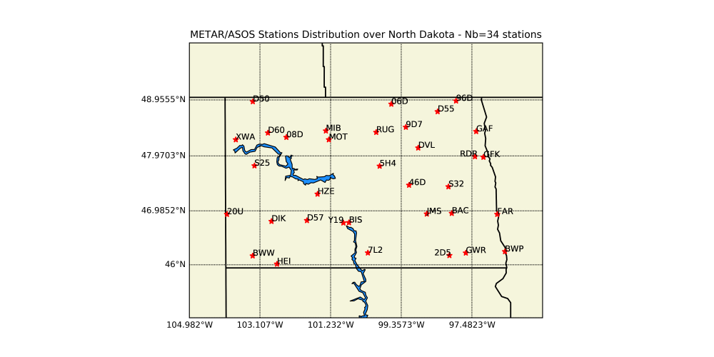
Visibility surface observations from ASOS/METAR (https://mesonet.agron.iastate.edu/request/download.phtml?network=ND_ASOS#) database on the Iowa State website. Files provided are .csv and used in the IFR/LIFR plots and comparison graphs.
- Station/Network: One file with all stations in North Dakota for IFR/LIFR plots and another file with the nearest city to the fog event for comparison graphs.
- Data: Visibility [miles]
- Timezone: Coordinated Universal Time (UTC)
- Data Format: Comma Delimited
- Include Latitude + Longitude: Yes
- Save result data to file on computer
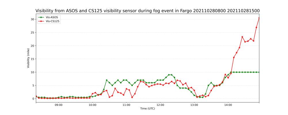
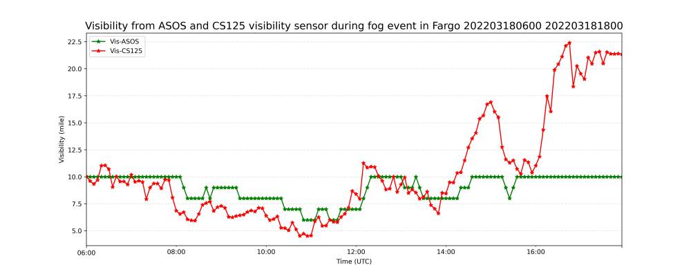
CS125 visibility sensor mounted on the MetTrailer (http://mettrailer.atmos.und.edu/). Data downloads as one large .csv file.
- Datatype: Last Visibility (mi)
- 5 minute interval
Camera data of the fog event from the deeplens cameras mounted on the MetTrailer.
2. Results: Comparison of GOES-R FLS observation with surface observations during the Fog event (maps and time series focusing mainly on area where the fog event occured).
3. Scripts: Scripts can be run when in Aircraft on Linus Terminal. (ssh -p 22000 aircraft.atmos.und.edu)
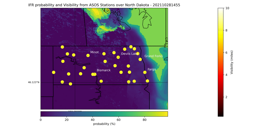
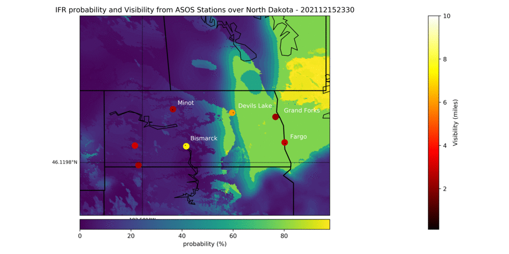
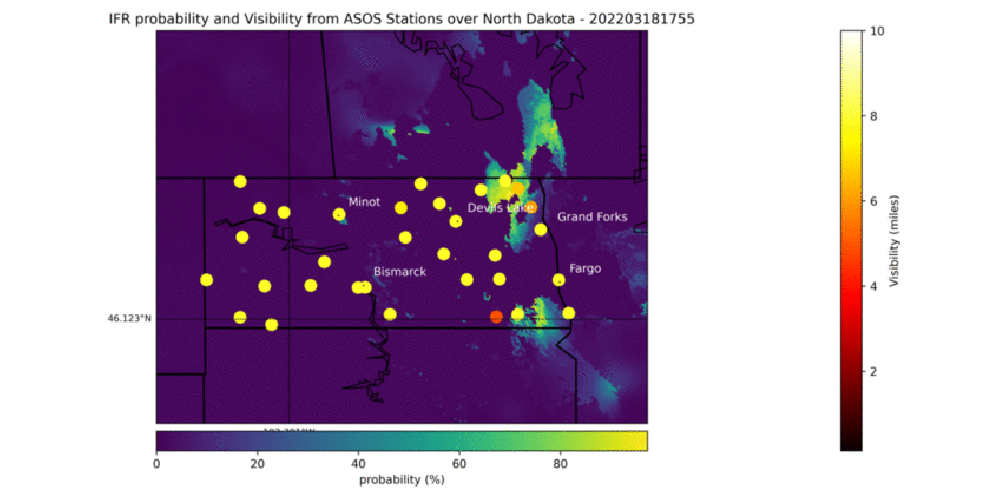
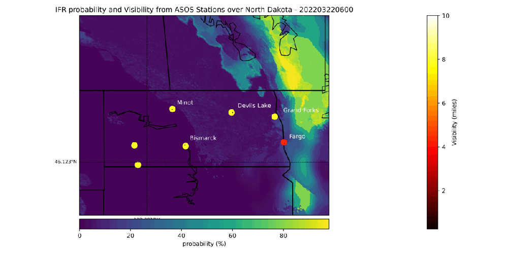
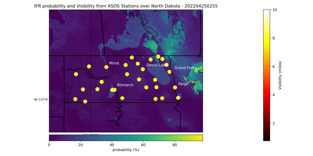
“plot-map-IFR.py” is used for plotting ASOS visibility and NOAA IFR visibility.
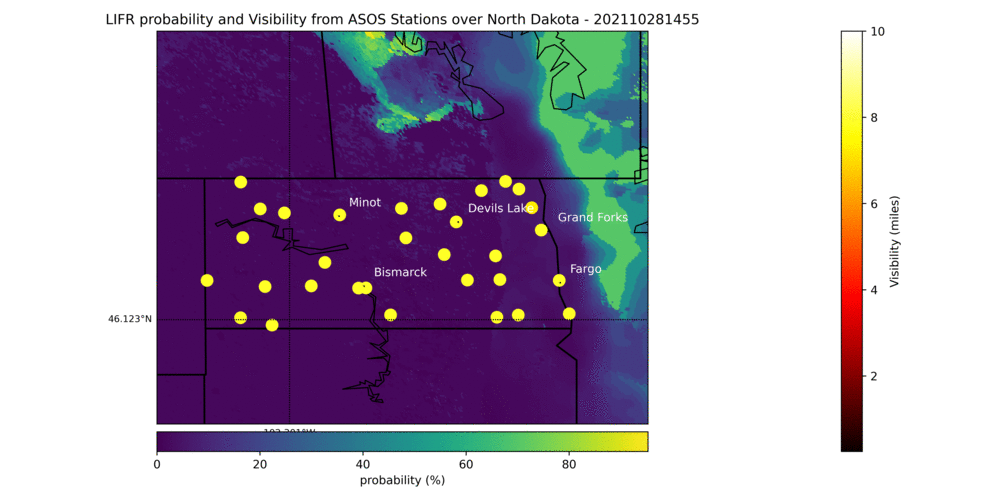
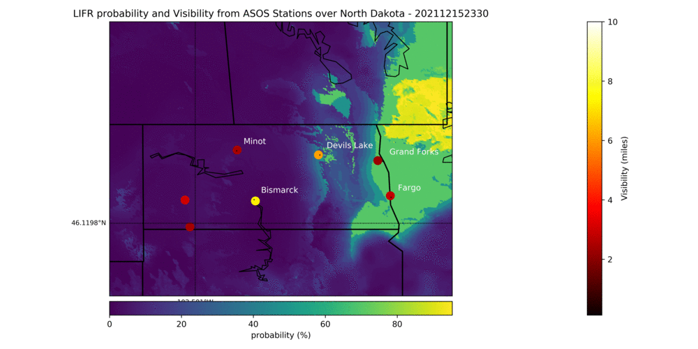
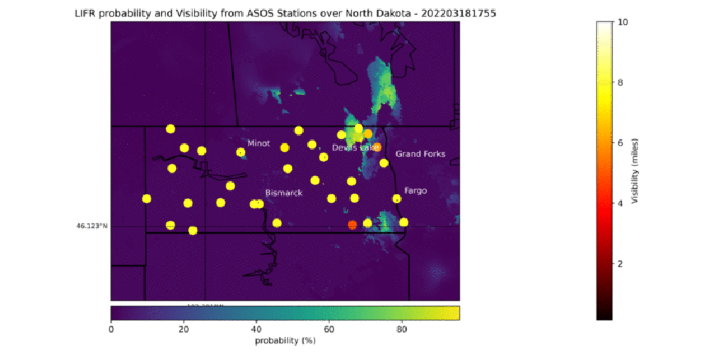
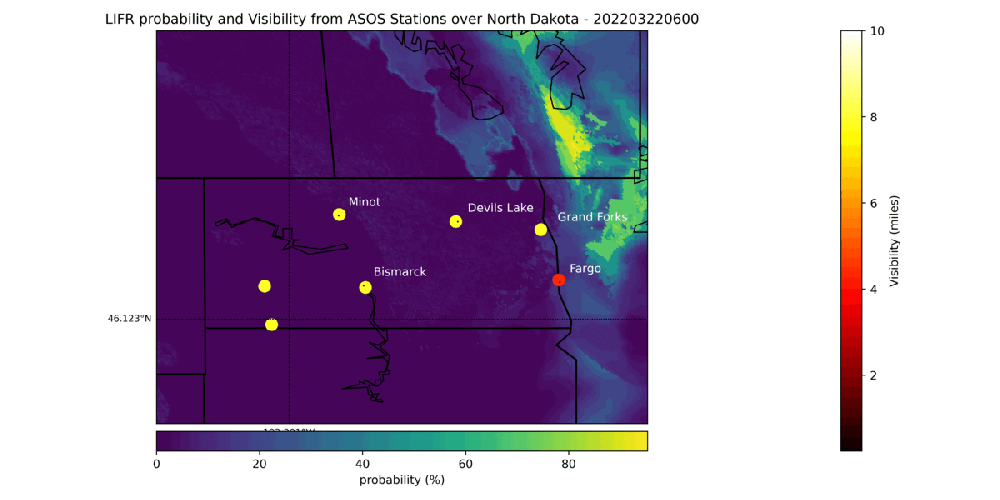
“plot-map-LIFR.py” is used for plotting ASOS visibility and NOAA LIFR visibility
August 28, 2021 11:00-20:00 UTC Grand Forks, ND
No data available from NOAA CLASS GRABINDE.
October 28, 2021 08:00-15:00 UTC Fargo, ND
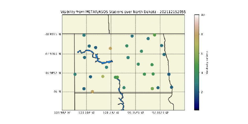
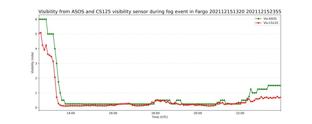
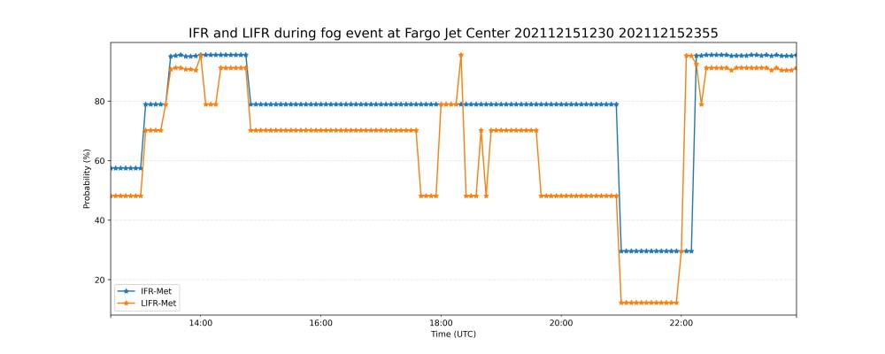
December 15, 2021 12:30-24:00 UTC Fargo, ND
Double click image to see full GIF. The images begin at 13:38 UTC and end at 19:04 UTC in 1 to 2 min intervals.
February 11, 2022 04:00-12:00 UTC Grand Forks, ND
Created By: Alex Troxel
March 18, 2022 12:30-24:00 UTC Fargo, ND
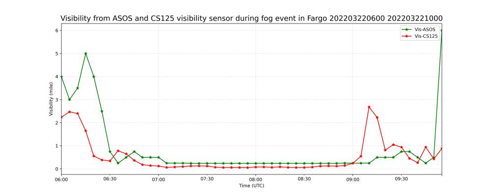
March 22, 2022 6:00-10:00 UTC Fargo, ND
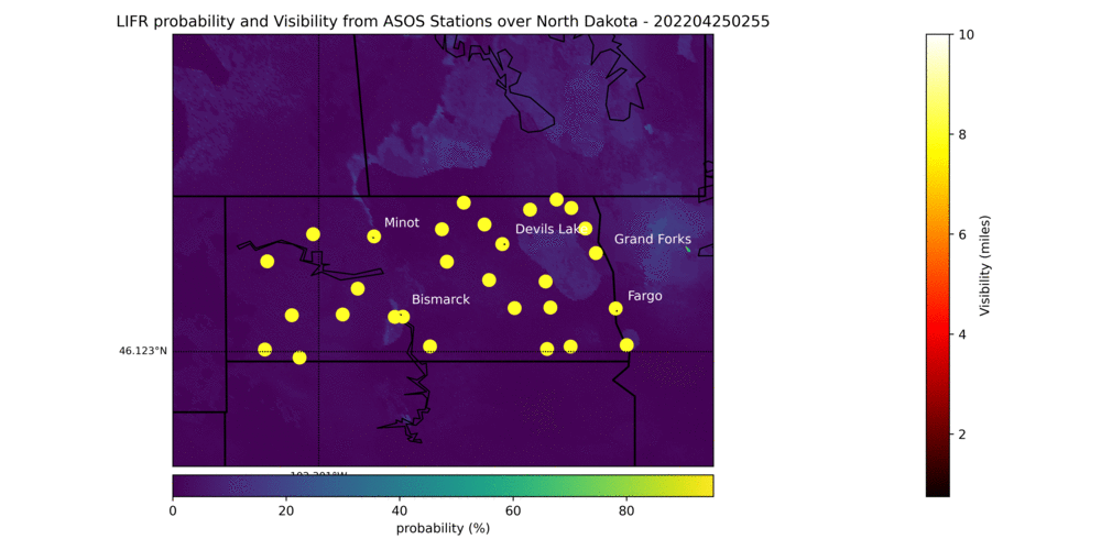
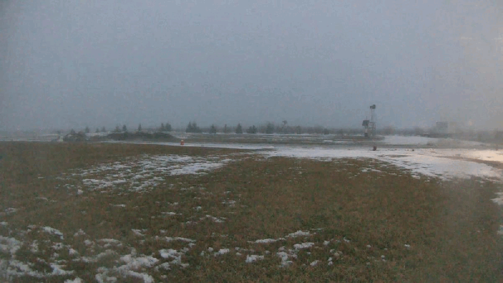
April 25, 2022 00:00-03:00 UTC Grand Forks, ND
June 14, 2022 06:00-13:00 UTC Grand Forks, ND
Meeting Notes
2022/04/01
- Attending: Alex Troxel, Marwa Majdi, David Delene
- Marwa - Send some scripts and information, Alex post some information on this Wiki. We have done Dec. 15, 2021. Provide example so we(you) can do another day.
- Marwa - Will create path on Aircraft.
- David - Weekly Meeting via Zoom at 3:30-4:00 pm. Get a Zoom and Camera setup on Linux and Windows computer in 422.
2022/04/04
- Attending: Alex Troxel, Marwa Majdi, David Delene
- Linux permissions.
2022/04/11
- Attending: Alex Troxel, Marwa Majdi, David Delene
- What/how to get data. Next case is 28 August 2021 from the hours of 1123 UTC to 1958 UTC. Need for Grand Forks, North Dakota; however, get all data and will subset. Link to data is https://www.avl.class.noaa.gov/saa/products/welcome
2022/04/25
- Attending: Alex Troxel, Marwa Majdi, David Delene, Christian Nairy
- Christian will share his Image data scripts for adaptation into this project.
- Revised Marwa's python scripts from December 15 to use for other fog events.
2022/05/02
- Attending: Alex Troxel, Marwa Majdi, David Delene
- Alex will get satellite data and compare the MetTrailer data and ASOS data.
